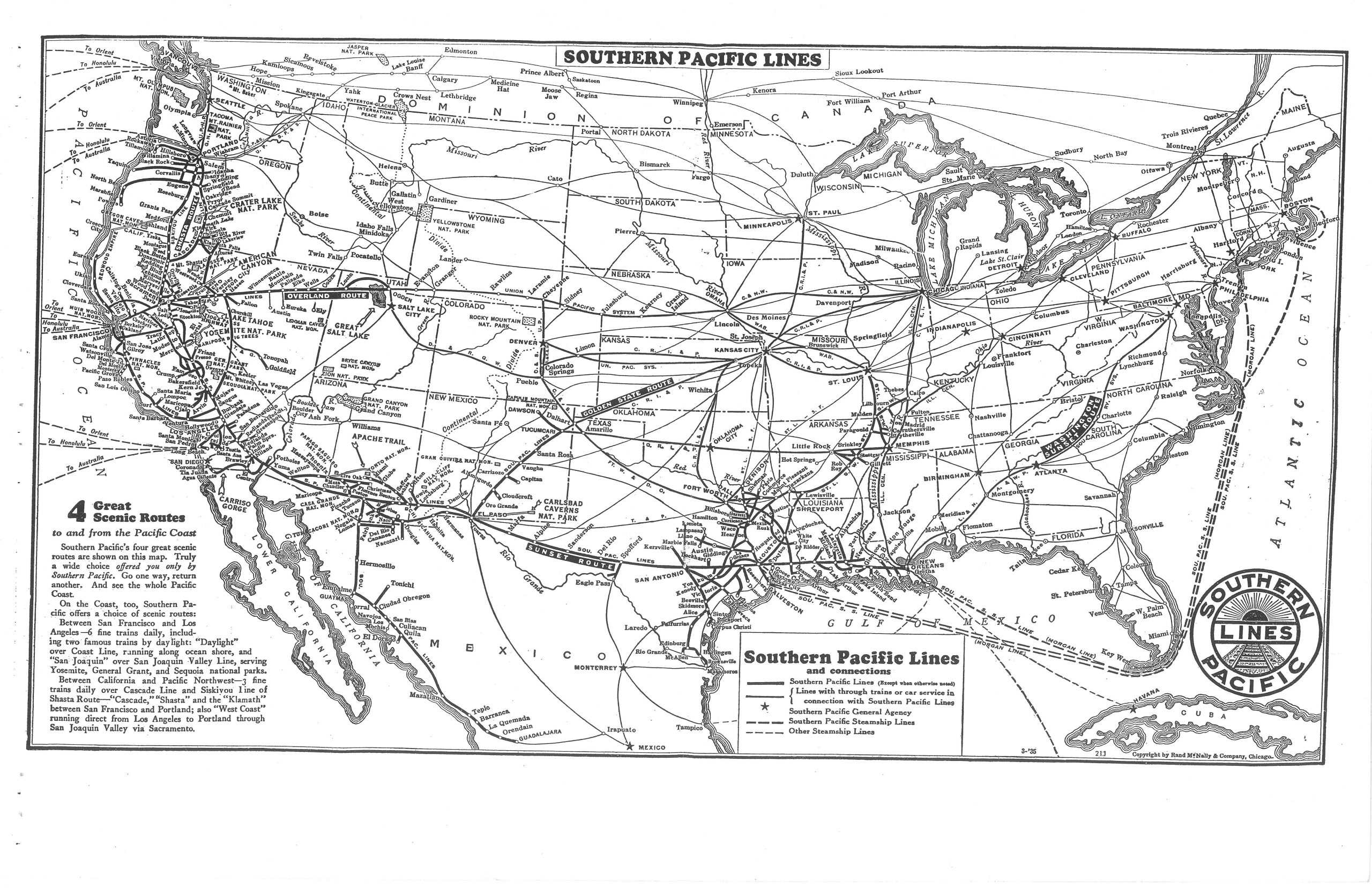
Most of the maps are more than 100 years old and they show all the lines of Southern Pacific at essentially the time of its peak growth of main and branch line trackage. Included are Southern Pacific’s then 18 divisions, circa 1920. There are also maps of the Pacific Electric, Northwestern Pacific, Electric Lines of the East Bay (across the San Francisco Bay from the San Francisco Peninsula), Southern Pacific de Mexico, Carson & Colorado, and more.
This collection is available in a downloadable PDF format, so that one can enlarge the maps and explore the features of each in detail.


Reviews
There are no reviews yet.